Yükleniyor...
Radiation sources are classified into two categories:
natural and artificial. Throughout their lifetime, humans receive the majority
of their radiation exposure from natural sources. According to the Sendai
Framework for Disaster Risk Reduction, natural radioactivity is regarded as
a geomedical hazard. In our country, earthquakes and their effects on the
ground are the primary factors considered when selecting settlement areas.
However, there is naturally occurring ground-based radioactivity that affects human
health over time, particularly causing lung and tissue cancers. An area that is
considered safe from earthquakes may still pose significant risks in terms of
radioactivity. Therefore, in both existing and new settlement planning, it is
essential to determine natural radioactivity levels and assess the associated
risks.
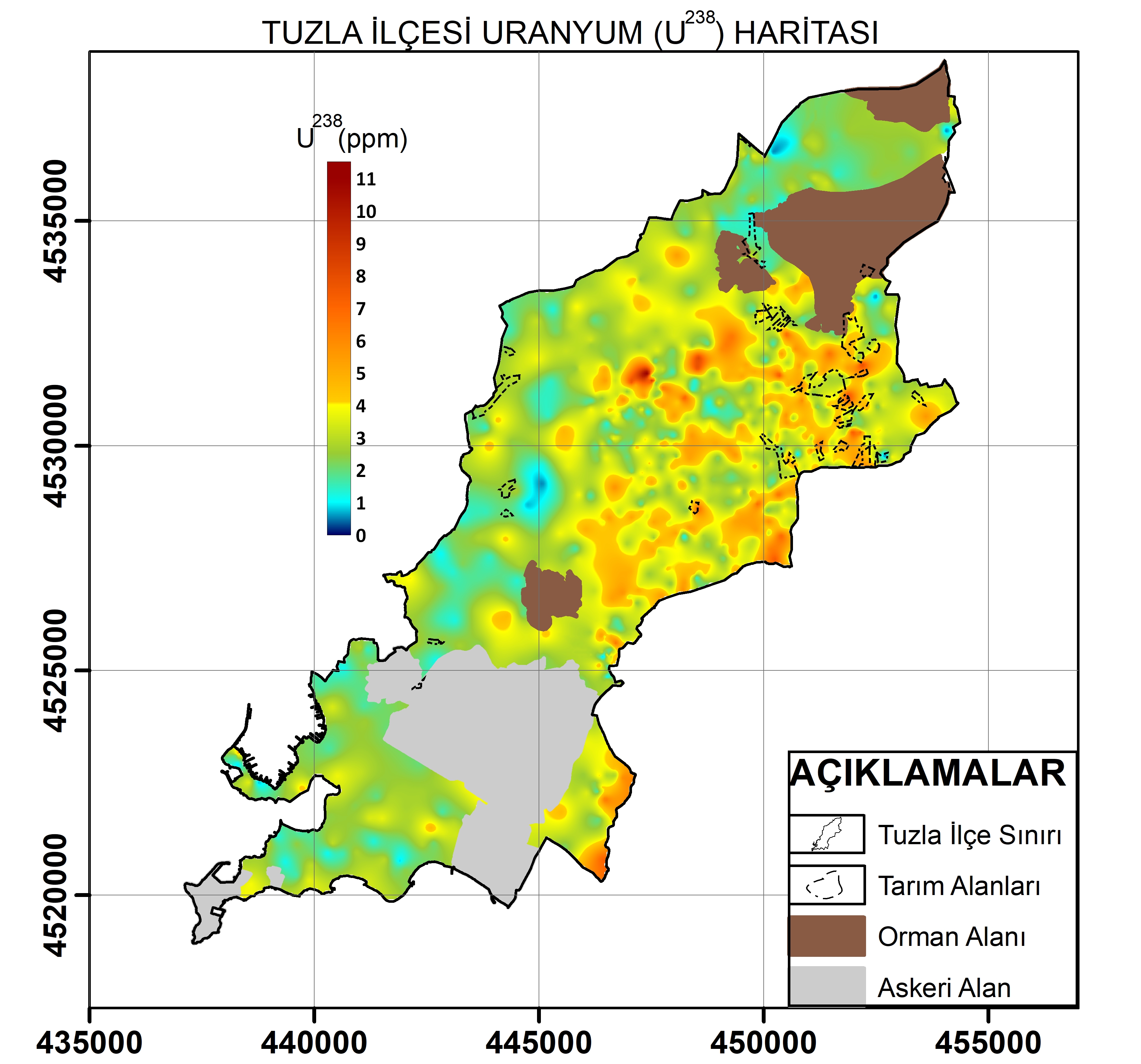
To
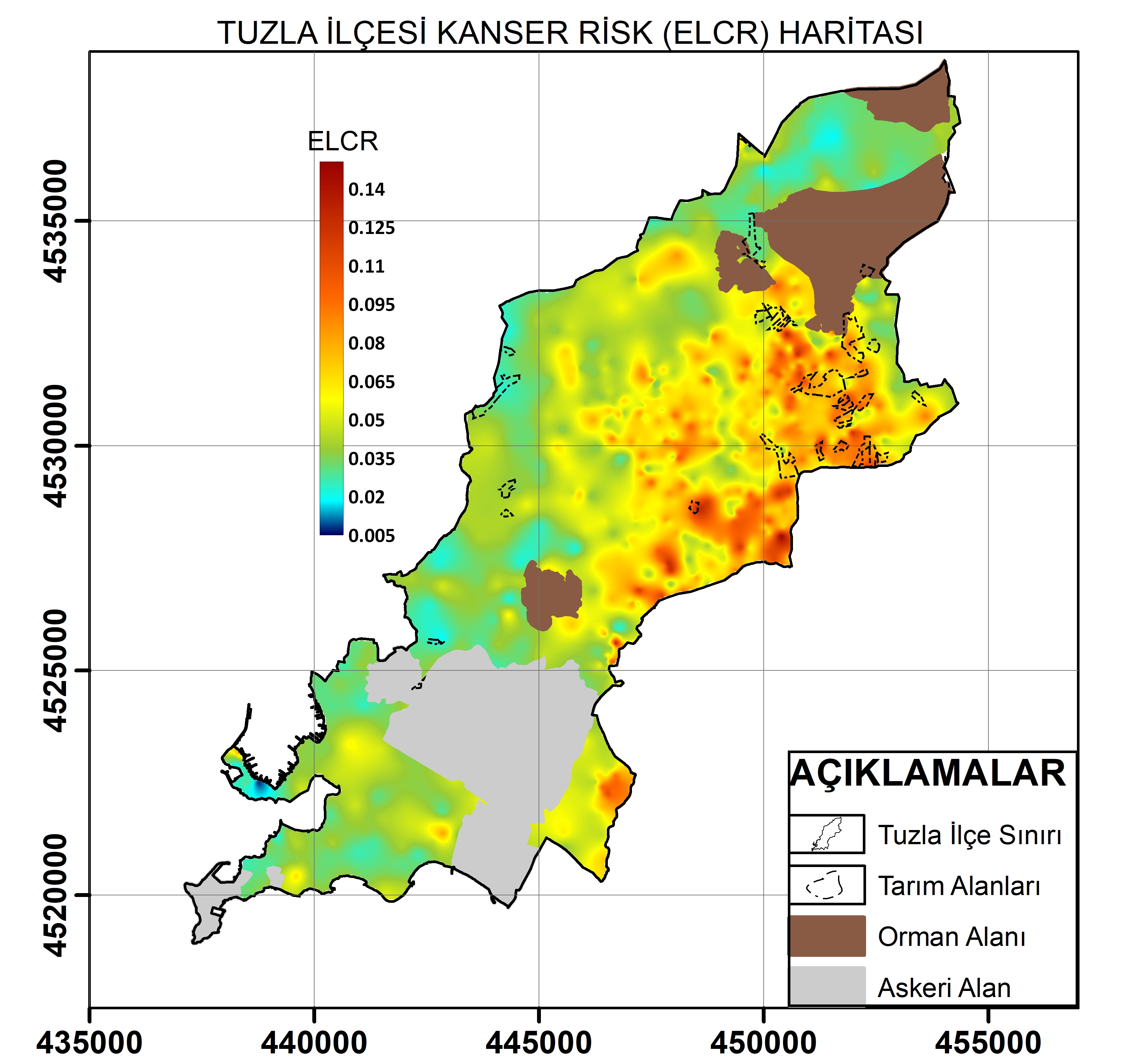
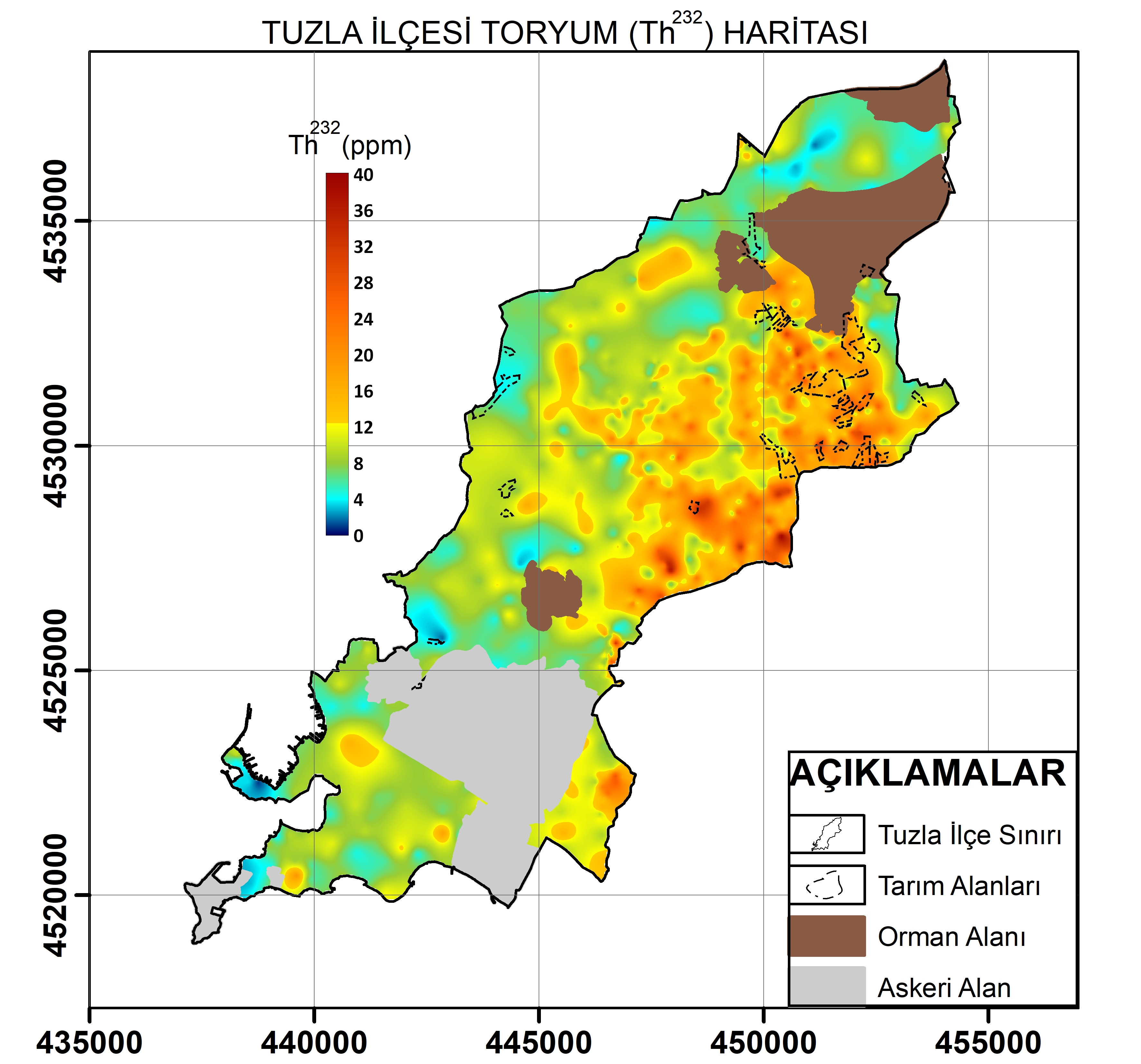
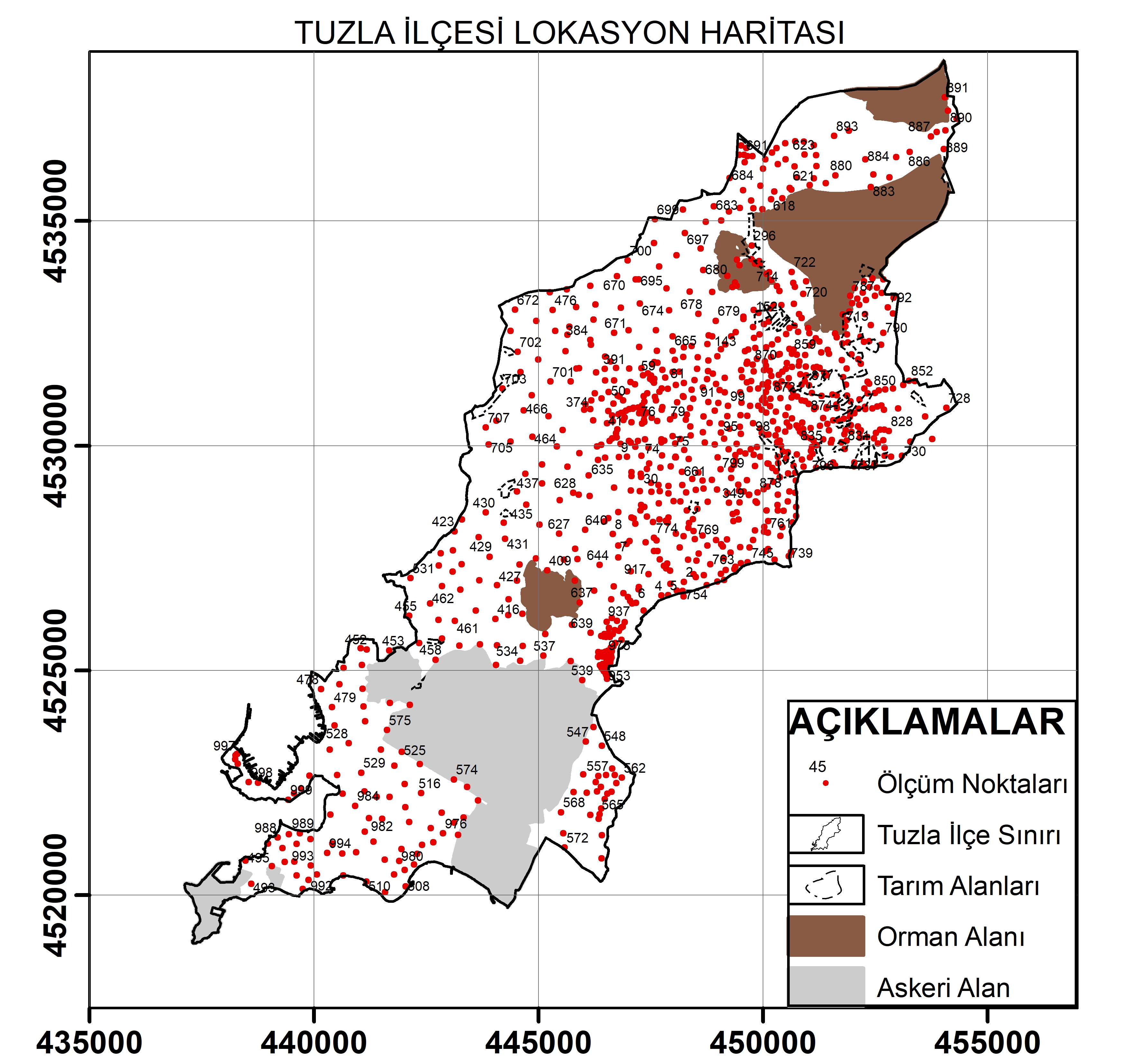
identify suitability for settlement and geomedical hazards, Tuzla District, where
large granite masses are found, was selected as the pilot area for natural
radioactivity measurements. Using geophysical (Gamma Spectrometry) surveys,
distribution maps of Uranium, Thorium, and Potassium were produced and compared
with Türkiye’s average values of TAEK (2010) and global average values of UNSCEAR
(2000). According to the survey results, the granite-covered areas of Tuzla
District have radioactivity levels approximately 2.5 times higher than the
world average and a potential cancer risk was determined.
When
we look at example studies around the world, all European Union member
countries have conducted natural radioactivity assessments and published the
results as the European Atlas of Natural Radiation. In addition, similar
studies have also been completed in North America, Slovenia, Israel-Palestine,
Egypt, and India. In our country, however, geomedical studies have remained
limited at the parcel scale. With this study, the radioactivity hazards and
risks of the pilot district Tuzla were identified, and for the first time in Türkiye,
a Geomedical (Radioactivity) Hazard Map of a district was produced.
Therefore, the project is both visionary and original.
As
is known, according to the Paris Climate Agreement enforced in 2016 and the Istanbul
Metropolitan Municipality Climate Change Action Plan published in 2021, investigating
water and soil quality is of great importance. In this context, by comparing all
radioactive maps obtained with existing geological, hydrogeological, and land
use maps, their impacts on agricultural land and groundwater were analyzed, and
recommendations were made to support the development of a sustainable city. It
was also evaluated that in areas where uranium levels are high, radon gas
emissions, known to cause lung cancer, may occur and radon measurements should
be conducted in these areas.
This
study will guide future work particularly related to urban planning, settlement
design, raising awareness of human exposure to natural radiation, and
developing protective measures. Hence, it serves as a baseline dataset for
public institutions such as urban planning and environmental protection
departments, AFAD (Disaster and Emergency Management Authority), and the
Ministry of Environment, Urbanization, and Climate Change, promoting
participatory collaboration. Based on the project results, the use of Radon
Gas Membranes is recommended in high-risk areas. It is anticipated that
such public-sector initiatives, in partnership with private industry, will
foster industrial and technological development, increase resilience, and
contribute to the national economy through the creation of structural
solutions.