Yükleniyor...
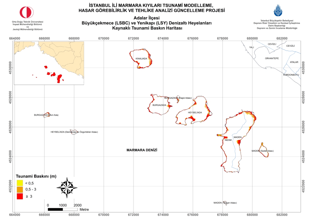
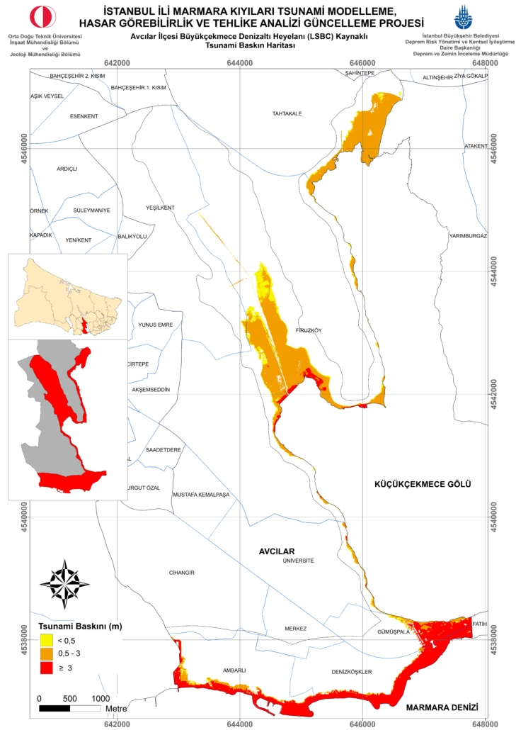
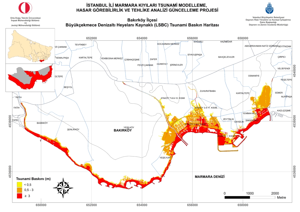
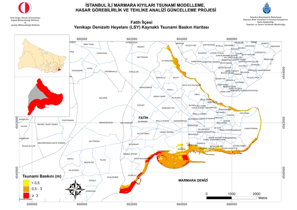
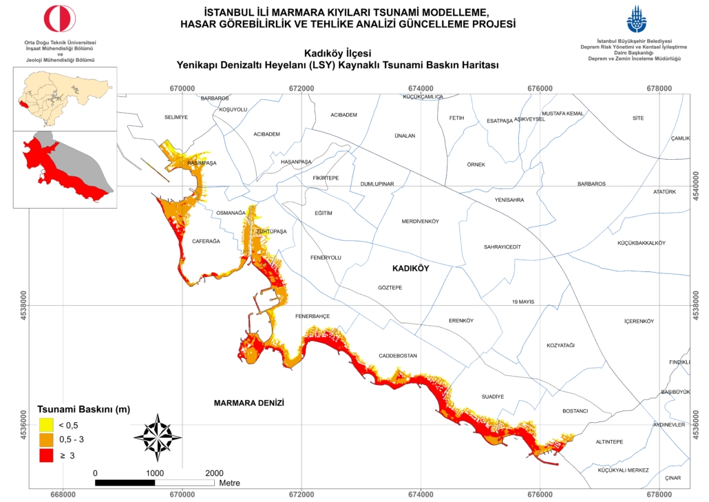
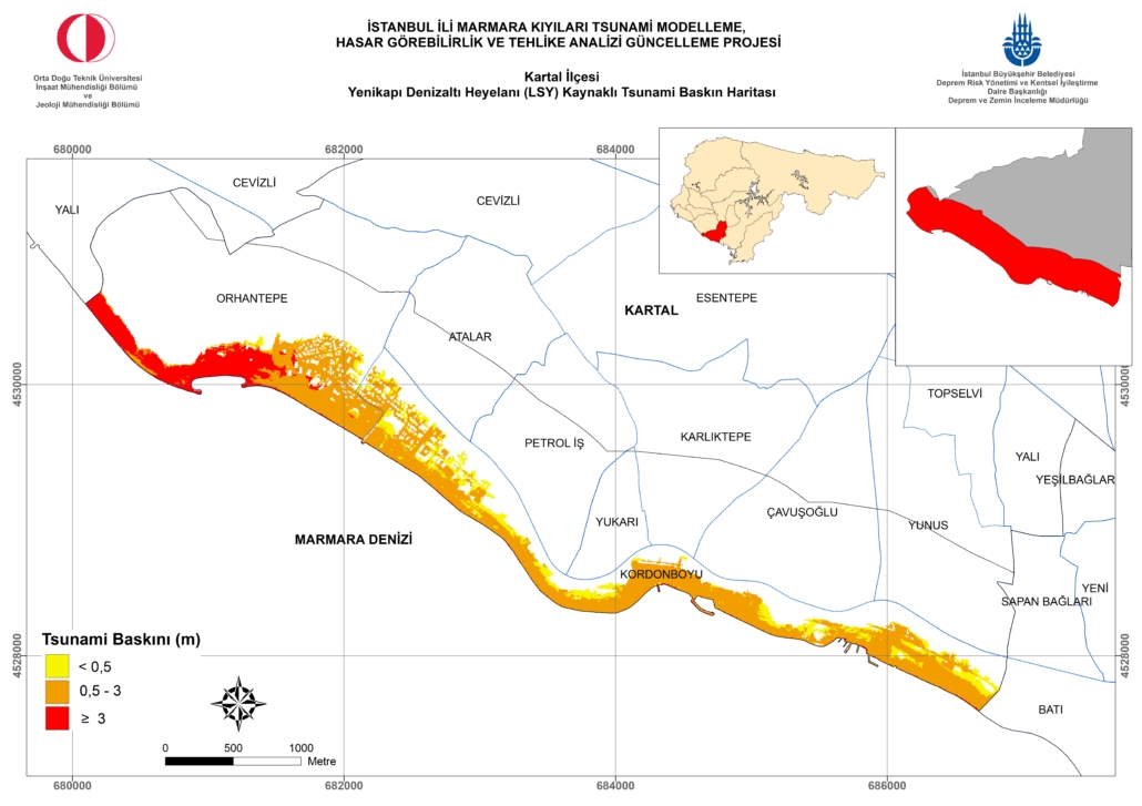
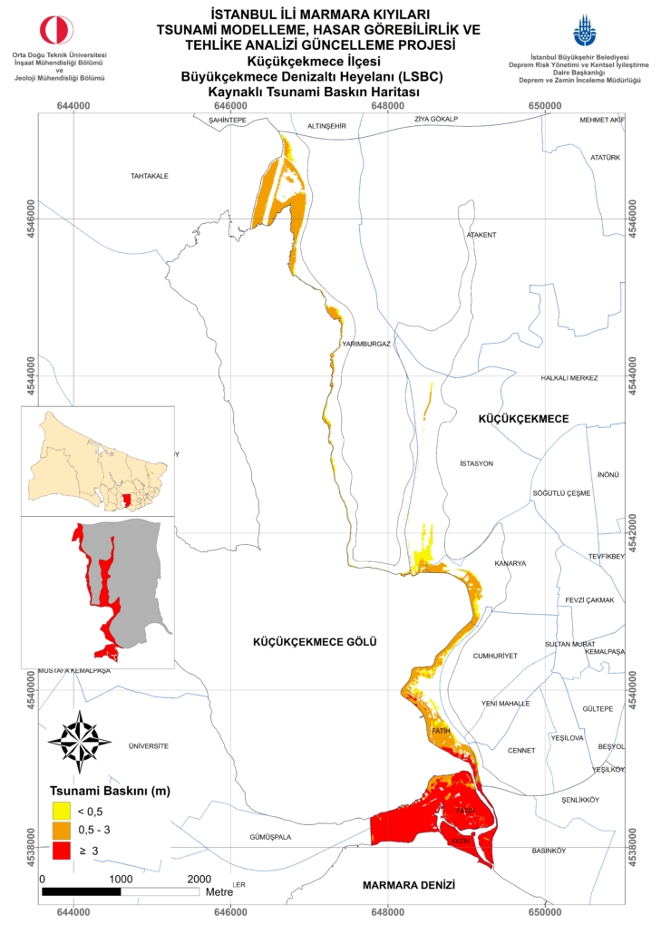
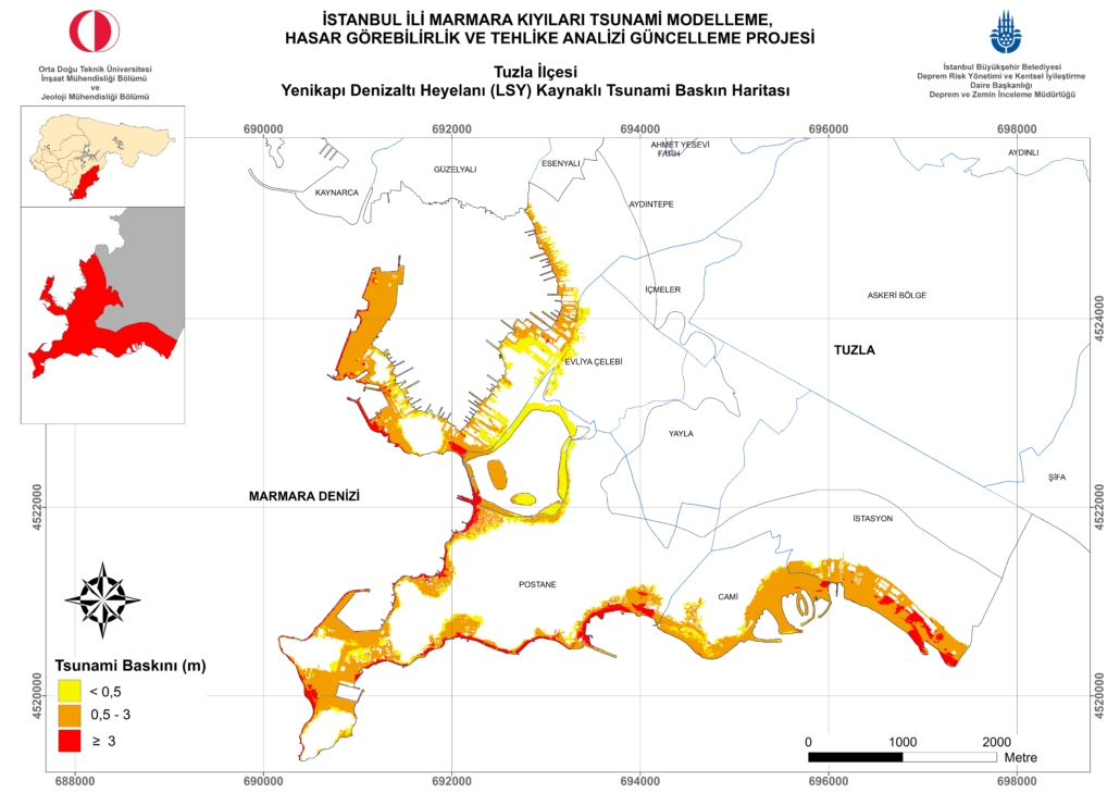
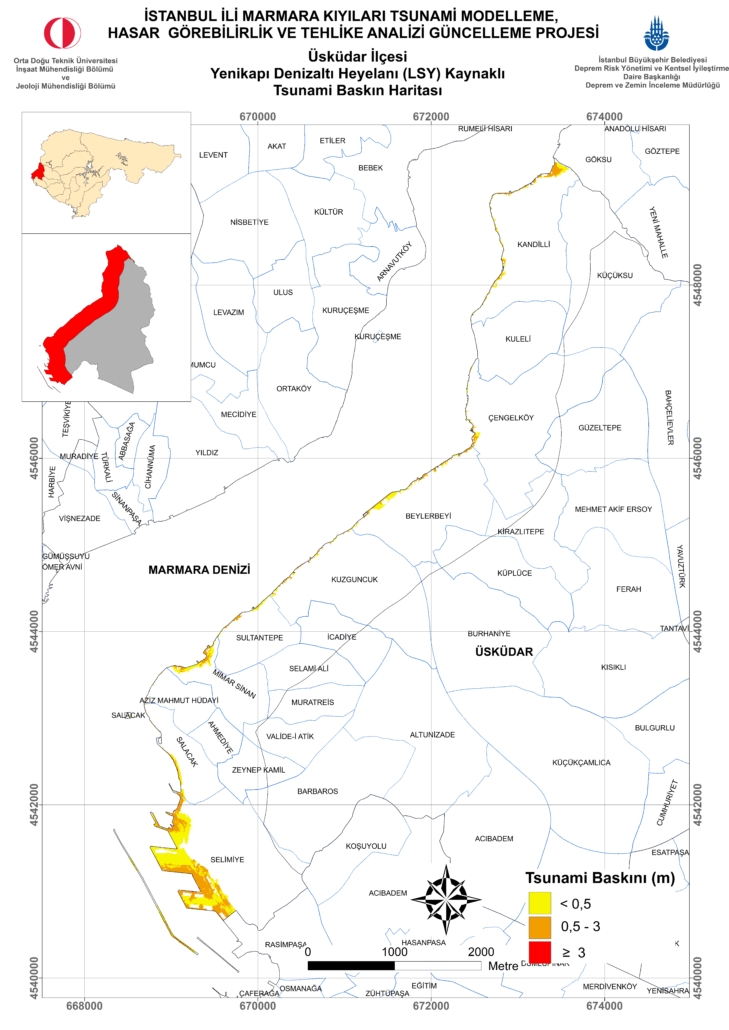
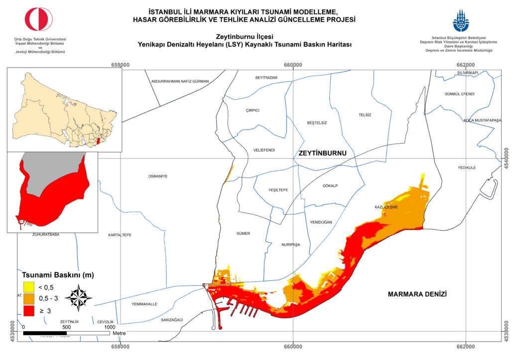
In line with scientific and technological developments both in our country and in the world, the “Tsunami Resilient Istanbul” approach has been developed by the IMM Earthquake and Ground Investigation Directorate in order to increase urban resilience against a possible tsunami affecting Istanbul, and a three-stage process has been defined. Accordingly, it was decided to re-analyze and evaluate the tsunami-related risk and risk components first, and thus the “Istanbul Marmara Coast Tsunami Modeling, Vulnerability and Hazard Analysis Update Project” (METU, 2018) was carried out. The resolution level used within the scope of the project is a first among tsunami modeling, vulnerability and hazard analysis projects conducted for megacities in the world, and district and neighborhood-based raid maps have been prepared according to each critical scenario. According to the results, it is seen that there will be a tsunami impact of variable but significant dimensions in all districts directly adjacent to the Marmara Sea.
Following the “Istanbul Marmara Coast Tsunami Modeling, Vulnerability and Hazard Analysis Update Project” (METU, 2018), the “Istanbul Province Tsunami Action Plan” (METU, 2019) study, which was designed to minimize the losses that a possible tsunami event that may affect Istanbul in general, to identify and detail the necessary steps by determining the precautions to be taken so that important critical structures on the Marmara coast are not affected by the tsunami or are minimally affected, and also to inform the relevant institutions and organizations about disaster preparedness, was completed as the second phase of the “Tsunami Resilient Istanbul” approach.
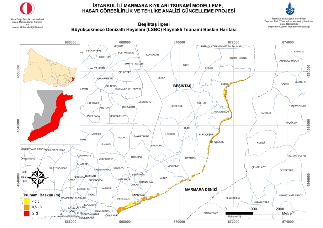
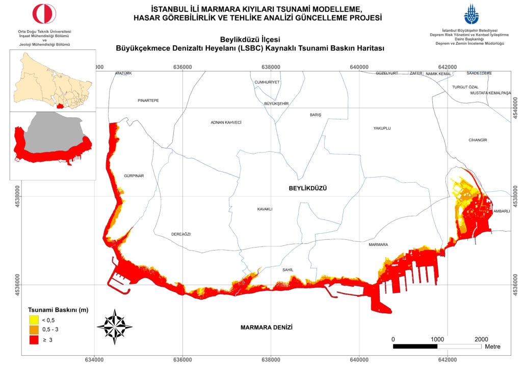
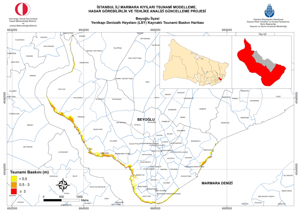
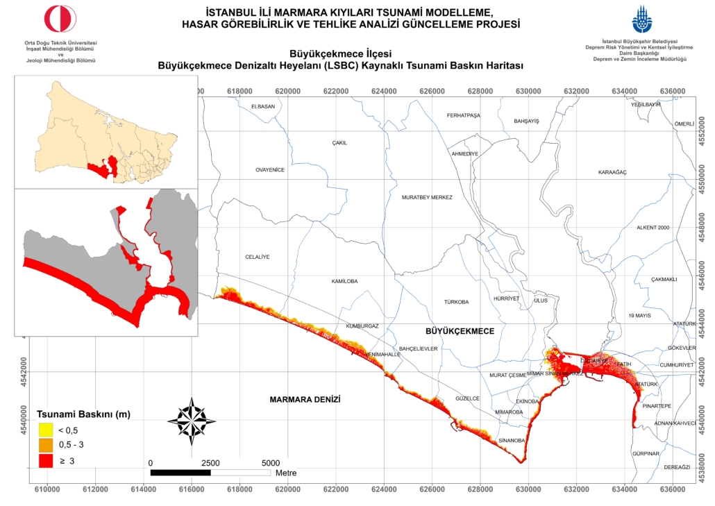
Following these two studies, the third phase aims to implement actions and strategies to reduce the predicted risk. This phase, which requires a longer-term and more comprehensive planning compared to the first two phases, depends on the proper ownership of the issue by the most important stakeholders, namely district municipalities, district governorships, other relevant institutions and organizations, NGOs and local people. In this context, special reporting was made for each district that will be exposed to the tsunami effect in order to understand the hazards and risks revealed by the analyses correctly and to ensure that the importance of the studies aimed at reducing the risks is understood and embraced by all stakeholders. In this way, it is aimed to enable decision-making and implementing units to focus more easily on the remaining hazards in their areas of responsibility and the necessary measures to reduce possible risks and to pave the way for the development of location-specific solutions.
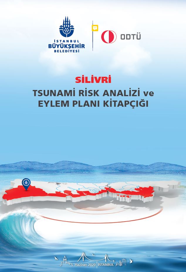
District Booklets and Evacuation Maps can be accessed from the links below.